Are you looking to introduce your kids or students to the world of maps? We’ve curated a list of highly recommended books that’ll get your kids excited about maps and geography. Here are our top suggested books for geography and social studies in the classroom or to use for reading time with your kids.
We’ve labeled each recommendation with the appropriate age to help you decide which books to try!
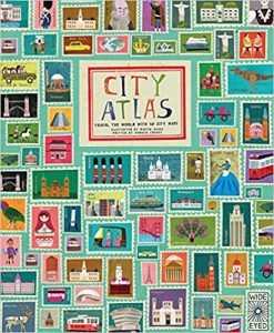
1. City Atlas: Travel the World with 30 City Maps (Ages 8+)
This book is illustrated by my favorite illustrator and map maker Martin Haake. It explores 30 different cities with fun places and things to discover with descriptions and facts. The book is very child-friendly since there are “can you find..?” stamps on each city map.
Adults and youth will also enjoy it as the illustrations explore each culture in detail. This book would certainly make people want to visit the cities as it is full of beautiful drawings, information, and significant landmarks that represent each city. These landmarks are not your typical tourist attractions, as they highlight authentic, original, and local experiences.
When you visit Tokyo, you’ll want to see the Ghibli Museum of animation, pet a rabbit at a bunny hug cafe, or grab dinner from a vending machine to finish your day. Or flip pancakes at the Kinderkookkafe and try a slice of dutch peach pie in Amsterdam. These are just a few examples of the authentic experiences featured in the book.
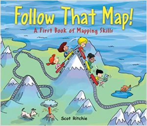
2. Follow That Map! A First Book of Mapping Skills (Ages 4+)
“Sally and her friends are playing in her backyard. Pedro notices that Sally’s dog Max and her cat Ollie are missing.” Through the search of Ollie and Max, the readers can follow Sally and her friends on their mapping journey. The book incorporates accessible map information that the kids can understand with cute illustrations.
The illustrations are children-friendly, and some stores and settings on each map are places kids like to go to, such as the candy store and the park. The kids can spot Ollie and Max somewhere on each page of the book, and they can explore from Sally’s neighborhood to the city, countryside and the rest of the world.
As the search for Ollie and Max continues, the book explains different maps such as topographic, treasure, and weather maps through beautiful storytelling. It also describes the essential map concepts like scale bar, paths and routes, compass, navigation, etc. This book is an excellent way for kids to learn about maps because it is easy to follow with simple explanations and diagrams—the perfect read for small children.
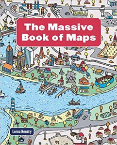
3. The Massive Book of Maps (Ages 7+)
The Massive Book of Maps is an excellent book for teaching young children about maps. This book explains the history, concept, and components of maps. The book also includes quiz activities for kids to develop geographical mapping skills and acquire knowledge of maps.
Map elements are explained in a simple way for kids to understand, such as grid coordinates, compassing, symbolism, GPS, and scales are all covered. There are also different types of maps like weather, political, fictional, and climate maps. After each topic, there are quiz activities for kids to answer to gain comprehensive knowledge of the subject.
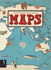
4. MAPS (Ages 10+)
Who doesn’t like the illustrated books designed by the remarkable polish duo Aleksandra and Daniel Mizielińscy? I’m a massive fan of their unique books and own four of them! Among their publications, the large hardcover book MAPS is a must-have for kids who want to explore the world. This book of maps investigates each country’s places of interest, cultural events, native animals and plants, iconic personalities, and more.
These beautifully illustrated maps will take you on an exciting adventure across the world. MAPS is recommended for age ten years and up and has over 112 pages. For those who want more, the Maps Activity Book edition is educational entertainment for kids.
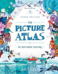
5. The Picture Atlas An Incredible Journey (Ages 8+)
From the Arctic Circle, Rainforest in South America to the traditional European foods, this book explores the world in detail. It’s truly an incredible journey that grabs the attention of the reader with highly engaging illustrations. Alongside the beautifully illustrated designs, the book has informative geographical and historical facts of each place. The author writes in a descriptive style that creates imagery in the readers’ heads, taking them to the world’s wonders. This book is ideal for ages eight and above—an excellent read for families too.
Each book can be used for different classroom purposes towards map making. Home school parents and caregivers can also access these books in their local library or online.
I hope these book reviews were helpful and would encourage kids to develop map-making and geographical knowledge to understand their relations to the world.
Thank you for reading!

